Water as a starting point
In a territory spanning approximately 1600 hectares, regeneration requires a gradual and strategic approach. Starting with the restoration of the water cycle was one of the first steps and it has since become a central pillar of Idanha-à-Vida, giving rise to one of the field team’s guiding mantras: water, soil, and biodiversity.
By slowing water down and allowing it to infiltrate the soil, the conditions are created for multiple regenerative processes: improving soil fertility, enabling the future development of regenerative agricultural practices, supporting the return of native forest, and increasing biodiversity.
More than simply storing water, the aim is to restore the landscape’s capacity to retain and distribute it, allowing it to regenerate naturally. Step by step, this begins to reverse a process of desertification that has taken decades to unfold.
This region is marked by significant temperature fluctuations and a climate that alternates between a dry and a rainy season, both tending towards extremes. In Idanha-a-Velha, water scarcity during the hottest months contrasts with periods of intense rainfall in winter. When soils are degraded or compacted, this water cannot infiltrate: it flows rapidly across the surface, carrying away soil, nutrients, and organic matter. Over time, this process forms erosion gullies and accelerates the loss of soil fertility.
This context is further intensified by decades of agricultural abandonment, the impacts of climate change, and the reduction in flow within the Tagus basin following the construction of the Cedillo dam in the 1970s. For this reason, restoring watercourses has become one of the first and most essential steps in the regenerative process.
Watercourses and landscape memory
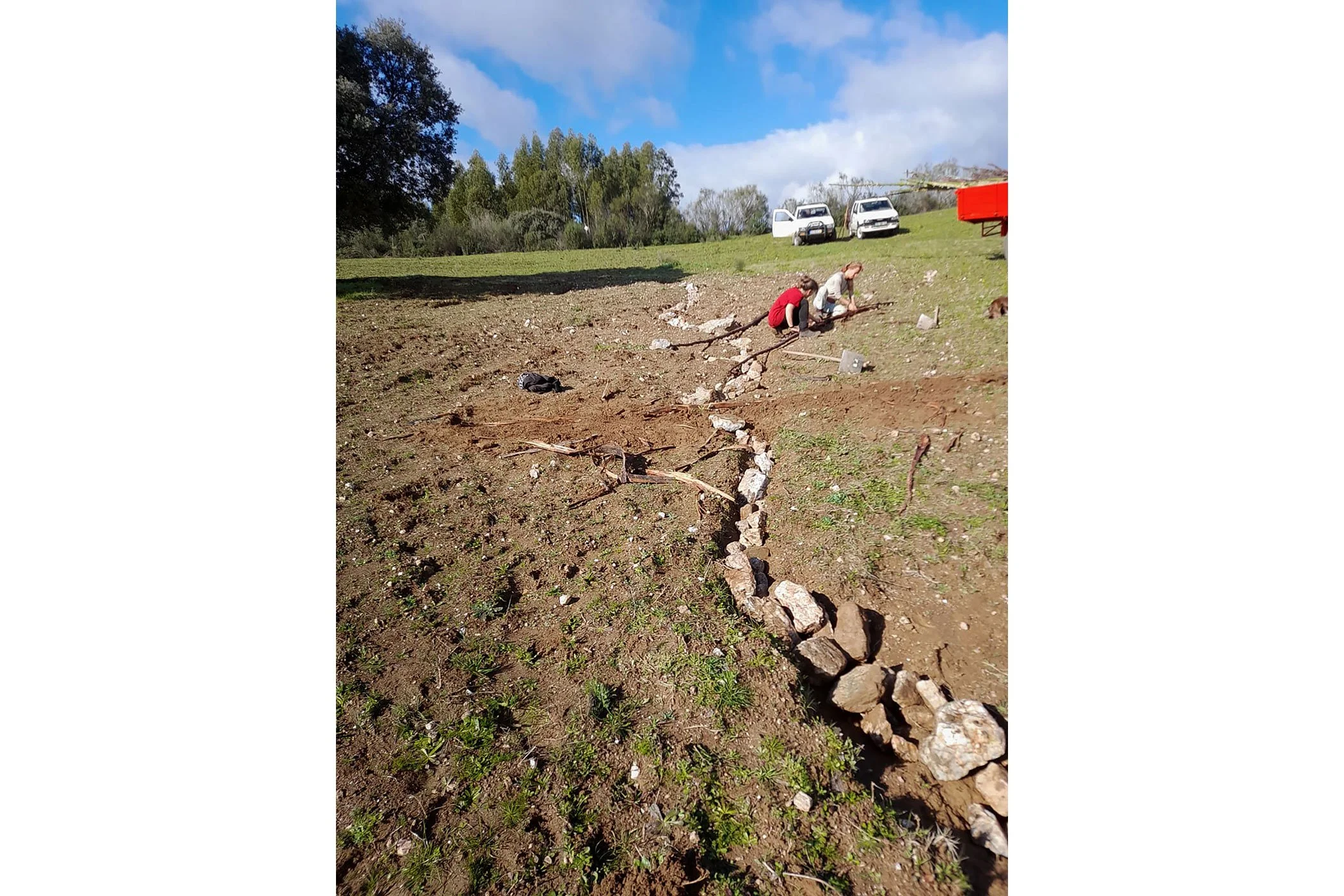
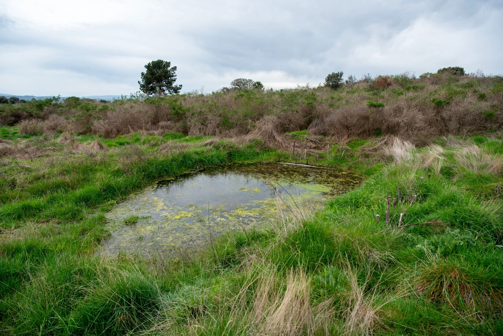
After analysing the characteristics of the landscape, the team began interventions in the northern area of the property, one of the main entry points for water into the territory. The land is crossed by a network of watercourses, including seasonal streams, springs, ponds, and the Pônsul River. Many remain active, yet are degraded or partially hidden by dense vegetation. In other areas, compacted soils prevent infiltration, causing water to run off across the surface and intensify erosion.
Restoring these watercourses is therefore a way of restoring part of the landscape’s functional capacity.
The work is grounded in principles of regenerative hydrology, combining direct observation of the land with traditional knowledge. Reading the landscape, particularly after the rainy season, makes it possible to identify where water accelerates, where erosion occurs, and where it can and should be retained.
From this understanding, small-scale interventions have been implemented across the territory, with a clear objective: to slow water down and increase its infiltration into the soil.
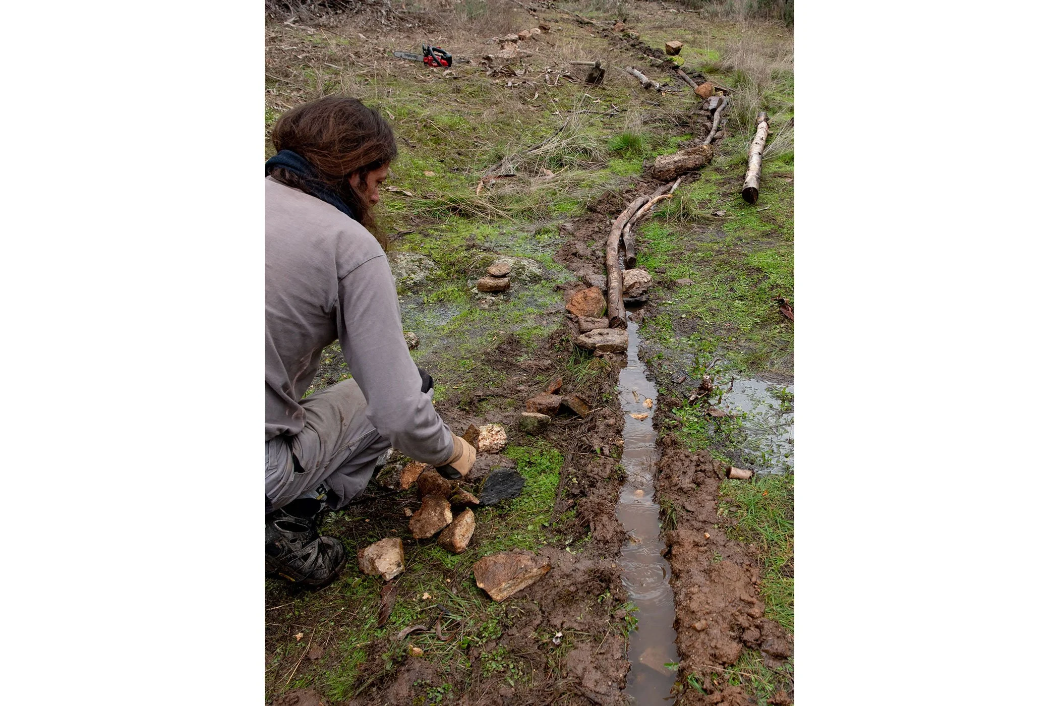
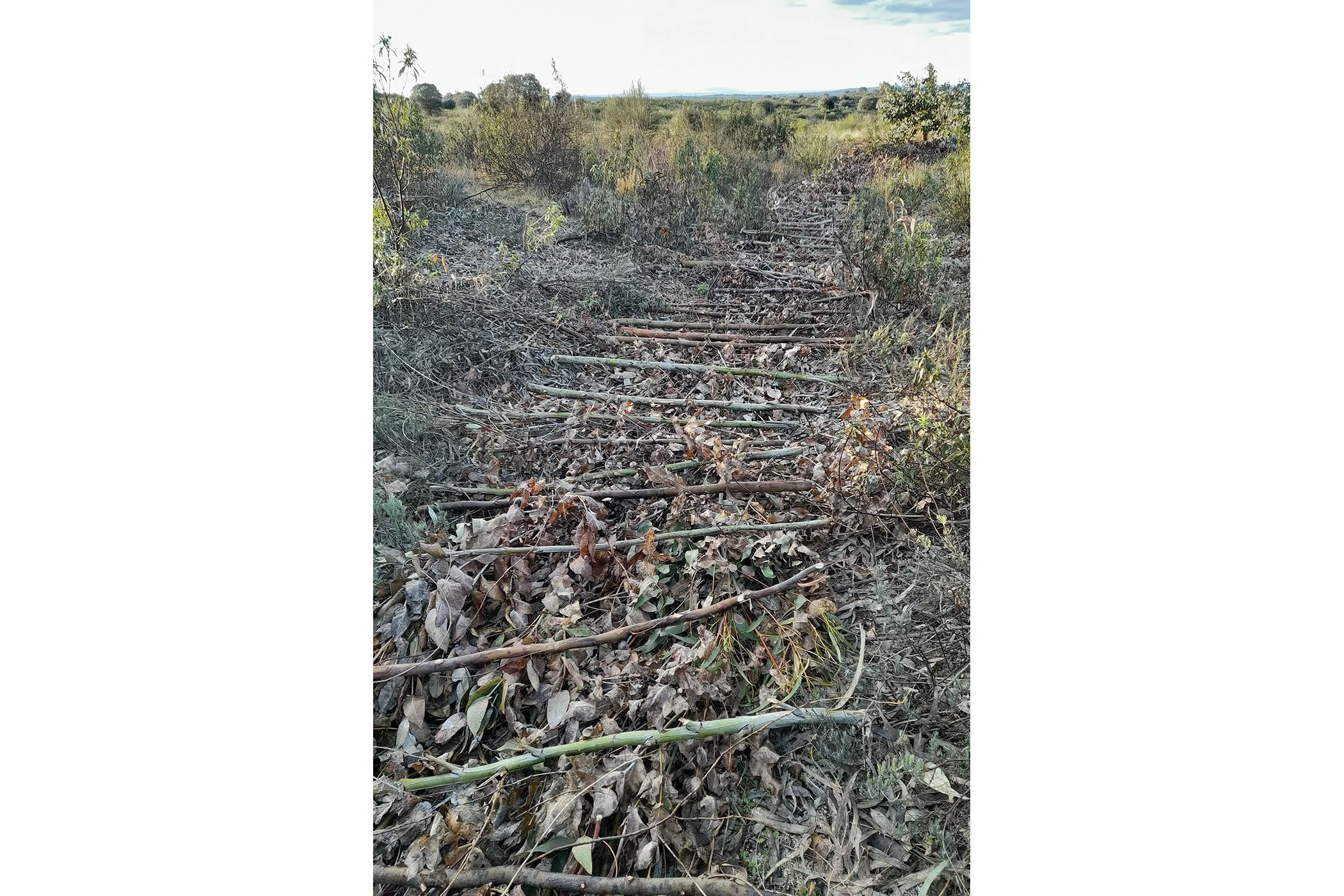
These interventions include small check dams in watercourses, infiltration lines along contour levels, land shaping to create ponds, planting riparian vegetation, and redirecting water from paths into lateral channels to prevent erosion and promote infiltration.
In the area affected by the wildfire in the summer of 2025, water retention structures have also played an important role — not only in reducing erosion, but in capturing nutrients from the ash of burned vegetation.
These solutions rely primarily on locally available materials, such as stones, logs, and organic matter, allowing for natural integration into the landscape. Most of the work has been carried out by the field team, with the support of volunteers, and without the use of heavy machinery.
What has been done
To date, around eight interventions have been carried out across different areas of the property, mainly focusing on watercourses showing clear signs of degradation and erosion.
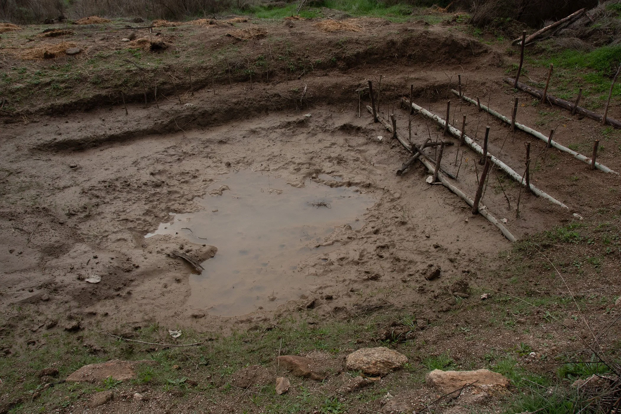
The work has concentrated on areas where water was flowing too quickly — creating gullies and carrying away soil and nutrients — as well as in burned areas, where the land was particularly vulnerable. In one of these locations, it was possible to recover a spring that had previously been hidden by dense vegetation.
The project is currently in an implementation phase, accompanied by continuous observation and monitoring.
Early signs of regeneration
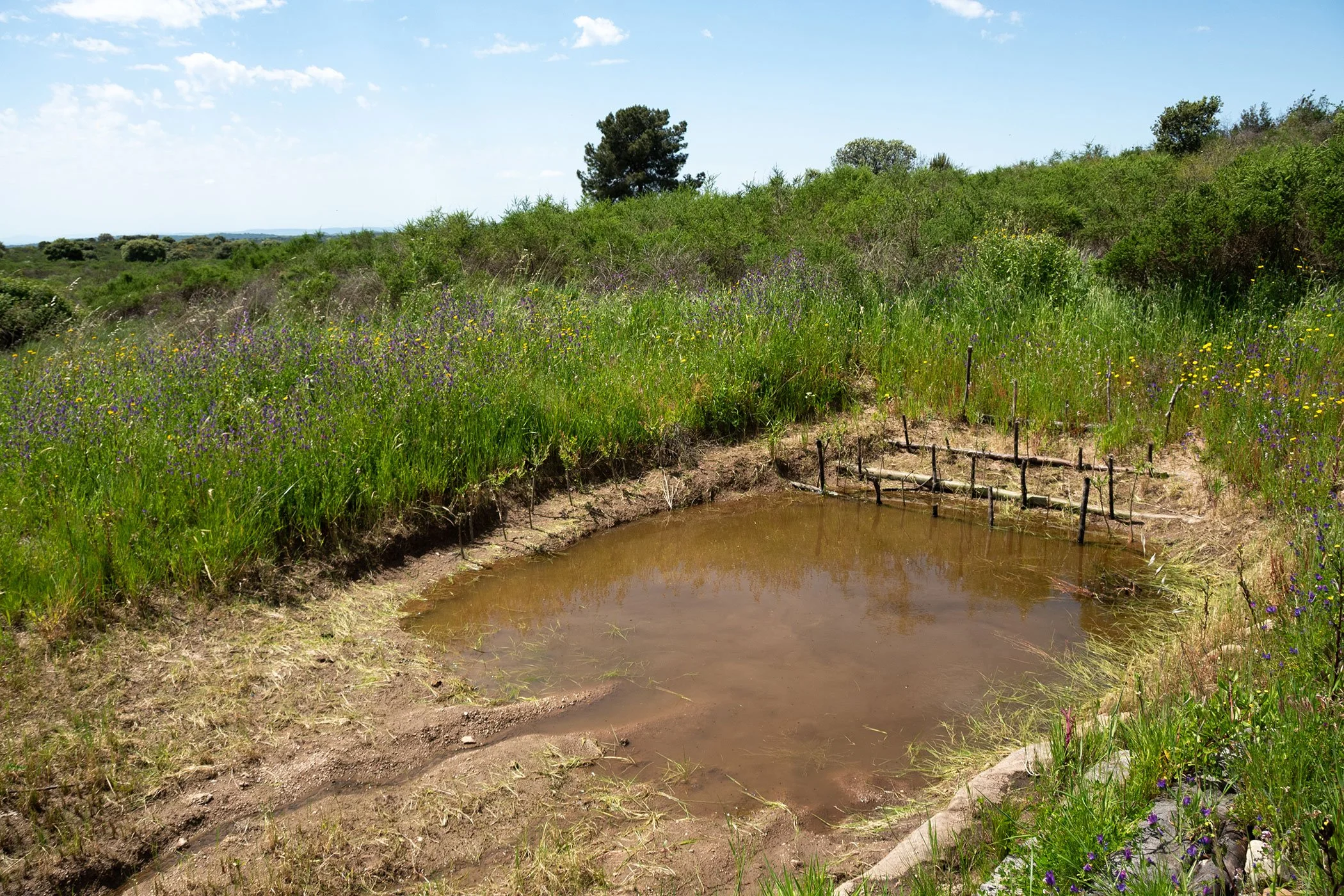
Although still in its early stages, the work is already showing encouraging signs. Following the rainy season, increased water retention, higher soil moisture, and improvements in soil structure have been observed, making it more porous and capable of absorbing water.
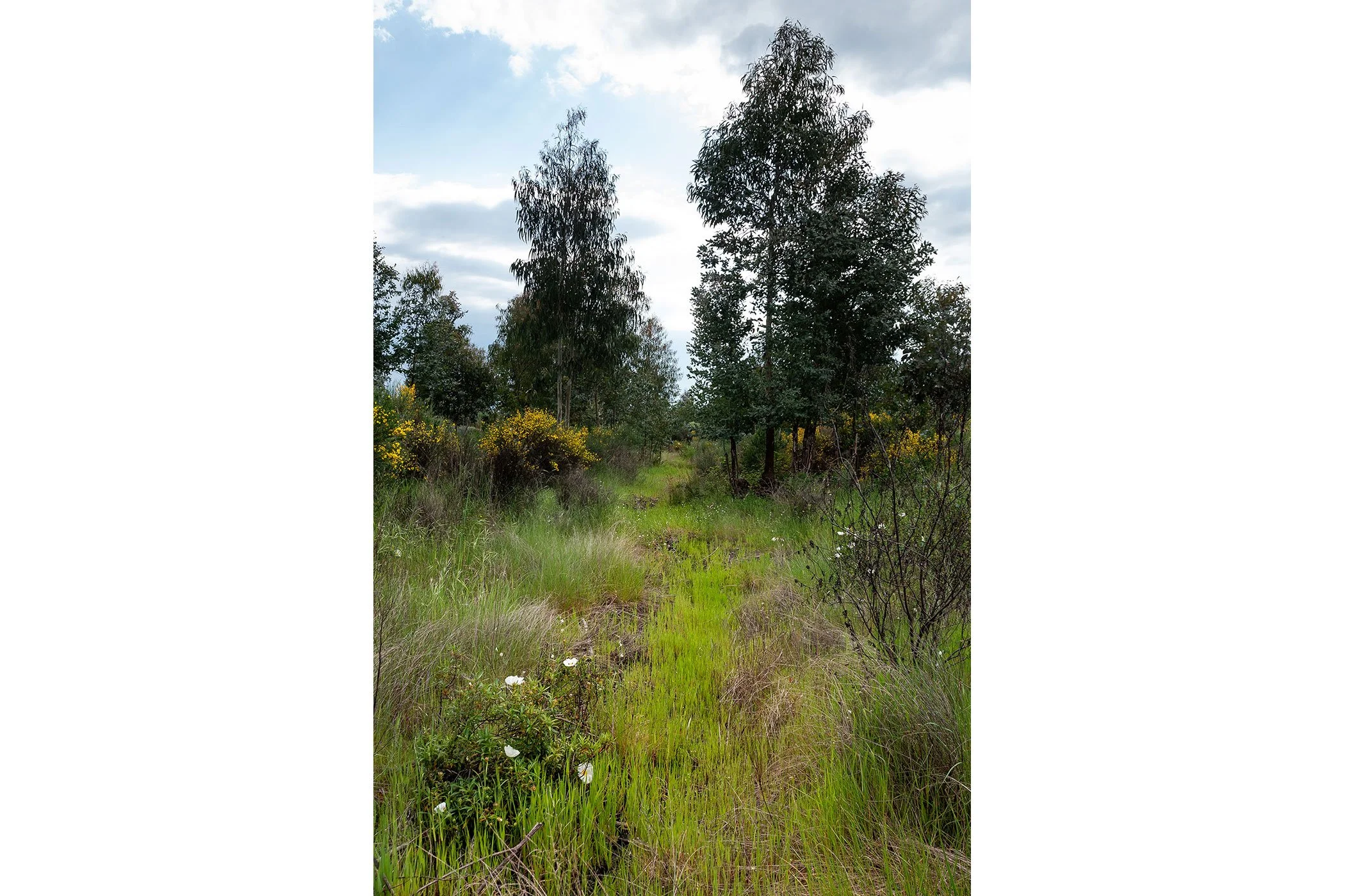
There are also emerging signs of ecological regeneration: soil moisture persisting later into the year, the appearance of spontaneous vegetation, the expansion of riparian flora up to around one metre from the waterline, and a growing presence of fauna. In several areas, amphibians and aquatic insects have already been observed, along with the spread of rushes (Juncus effusus), which are strong indicators of habitat recovery.
More than immediate results, this work requires time, observation, and continuity. Each intervention becomes a way of learning from the land — understanding how water moves and how the landscape responds. Direct engagement with the territory has also deepened this relationship, where knowledge is not only transmitted but experienced through practice.
Restoring water in the landscape is, ultimately, about reactivating the processes that sustain life and creating the conditions for the territory to regenerate from its own potential.